Large and Small Details of WWII Preserved by Texas A&M University Libraries
By Ivy Mestrovic, Communications Specialist
 Cushing’s maps collection includes a set of WWII service unit maps that detail the troops’ tragedies, victories and mundane activities.
World War II relics help tell the stories of veterans and the sacrifices they made for their country. Texas A&M University's Cushing Memorial Library & Archives is helping preserve those soldiers' legacies by digitizing a set of WWII service unit maps with a purpose beyond charting land. The maps contain personal, real-time observations of troops as they fought across the European Theater.
"These are documents created by units that often tell the story of the unit's wartime journey, including their activation, training, deployment, combat and demobilization," said Anton duPlessis, Military History curator.
Cushing's collection currently holds 121 maps from WWII, a war in which 20,229 Aggies served and 953 died.
One map shows a location near the French-German border. It depicts the battle raging as ammunition rains down, buildings burn and soldiers fight for their lives. Maps printed in various sizes and color schemes and by different methods detail war's tragedies and victories. Some maps are straightforward renditions of troop movements, while several include collective memories through handwritten notes and illustrations.
There are also observations about the more mundane aspects of troop life and movement.
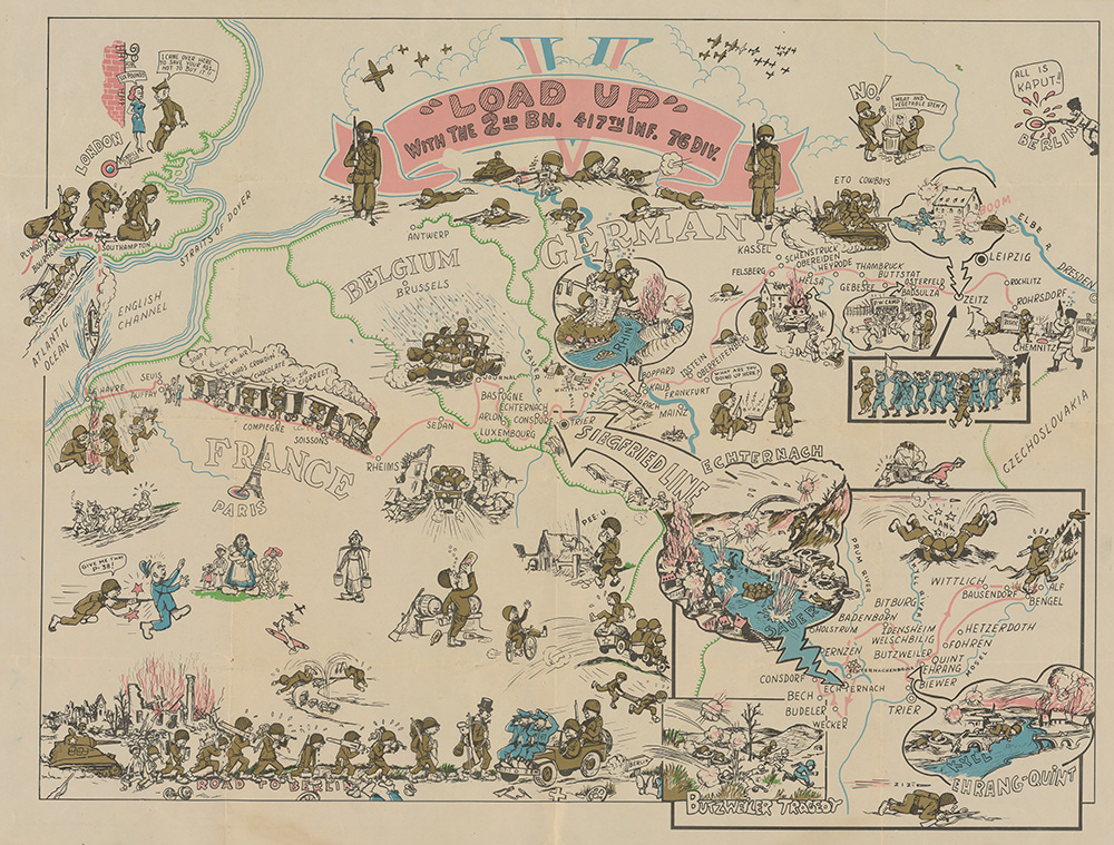
The "Load up with the 2nd Bn. 417th Inf. 76 Div." map is a series of vignettes covering the battalion's journey through the European Theater. A cartoon train overloaded with soldiers illustrates its journey from Seuis, France, to Reims, France. In the exhaust smoke of the train, the cartographer wrote "who's crowdin'," "chocolate," "give me air" and "zig-zag cigarette." As the troops move toward the border of France and Germany, there is a drawing of an American soldier holding his nose as he walks by a farm with the phrase "PEE-U" written above.
"Almost all of these maps were produced overseas during the war, rather than when the soldiers came back to the U.S.," said duPlessis. "Which makes the more colorful, quirky maps all the more interesting since they went to that sort of effort, given where they were and when."
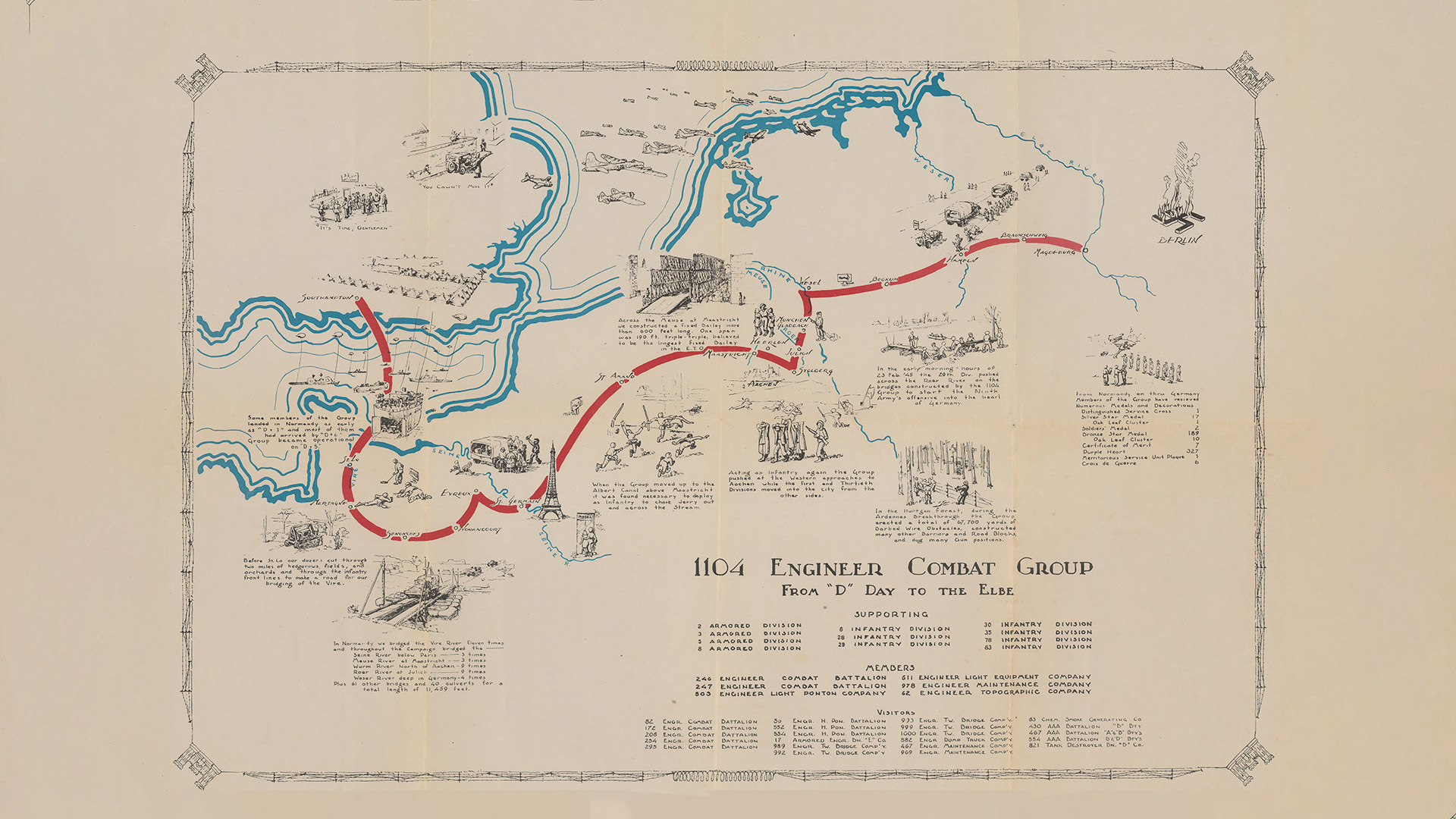
The "1104 Engineer Combat Group for 'D' Day to the Elbe" map notes that during the Ardennes Breakthrough, the combat group erected a total of 67,700 yards of barbed wire obstacles, constructed many other barriers and dug many gun positions. The conflict became more commonly known as the Battle of the Bulge, the last major German offensive in the European Theater and one of America's deadliest campaigns. References to the battle, in a variety of naming conventions, can be found throughout maps in the Cushing collection. The combat group's map also notes a list of honors awarded to members of the unit, including 327 Purple Hearts.
Events depicted on the maps can be compared against official military histories and records maintained by the U.S. military branches. According to duPlessis, this is how one can confirm where people were deployed.
Texas A&M University Libraries
Follow Us on Instagram
About Texas A&M University Libraries
Comprising five unique libraries, the Texas A&M University Libraries are a hub of resources, spaces and professionals supporting the success of research, learning and teaching. The Libraries’ advance student success and partner in innovative research, while providing a physical and digital home to all students, staff, faculty and researchers. To learn more visit library.tamu.edu